
 FuturePlus


此文为2020年第14届国际中国规划学会年会“深圳实践价值”12月5日深圳大学论坛发言分享,分上下篇发布,作为未来+深圳研究系列“深圳补惑 Why Shenzhen”的开始篇。

深圳巨变六维评估
The 6 Dimensions Assessment
of Shenzhen Booming
(上篇)
分享人:黄伟文
引子:城市四十不惑了吗?
Introduction: No confuses any more when city at forty?
让我们先看深圳在珠三角(大湾区)40年中的经济与社会表现,从几乎不为人注意的边境城镇(左图),到13738倍的经济增长和50倍人口增长(右图),远超过周边乃至全球其它城市,是名副其实的奇迹式的爆发。
Let us first look at the economic and social performance of Shenzhen in the Pearl River Delta (Grand Bay Area) in the past 40 years, from the border towns that are almost unnoticed, to 13,738 times economic growth and 50 times population growth, far exceeding the surrounding and even other cities in the world. It was a veritable miracle booming.

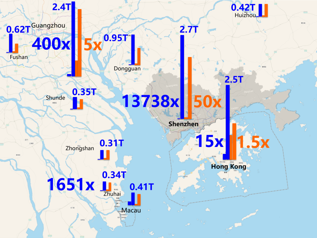
珠三角城市GDP和人口增长(1979-2019年)
The Increase of GDP(RMB) & Population (1979-2019) in PRD Cities
如何解读这种超乎寻常的巨变,而不只是反复叙述奇迹,是少部分研究者的工作。今年和2016年中英文版分别出版的《向深圳学习》,是以海外研究者为主关于深圳研究的著作,我有幸受三位主编马立安,黄韵然,乔纳森巴赫的邀请加入撰稿。我重点研究了塑造深圳的三种力量:政策与规划的北京,经济地理的香港,社会空间的宝安。
How to explain this extraordinary change, not just repeating the narrative of miracle, is the work of a small number of researchers. "Learning from Shenzhen" published in both Chinese this year and English in 2016, is a work on Shenzhen studies mainly by overseas researchers. I was honor to have been invited by three editors, Mary Ann 0’Donnell, Winnie Wong, and Jonathan Bach, to join the writing. I focused on the three forces shaping Shenzhen: policy and planning by Beijing, economic geography by Hong Kong, and social spatial by Baoan.
《向深圳学习》
LEARNING FROM SHENZHEN
深圳作为一项国家级的大型城市实验,一直还没看到其系统和全面的实验报告。三年前我在深圳城市规划馆的策展提案竞赛中发出这项呼吁,但没有得到回应。
As a national large-scale urban experiment, Shenzhen has not seen its systematic and comprehensive experimental report. Three years ago, I made this appeal during the curatorial proposal competition of the Shenzhen Urban Planning Museum, but received no response.
深圳城市规划馆策展及设计提案
Curatorial and Design Proposal to Shenzhen Urban Planning Museum
今年深圳特区四十周年庆典也非常隆重。一个到了孔子所谓“四十不惑”之年的城市,是只有不惑的、成片的“耶!”欢呼呢?还是能提出更多令人困惑的问题?
The 40th anniversary celebration of the Shenzhen Special Economic Zone this year is also very grand. A city has reached the age of Confucius’s so call "forty years old of no confusion" , is there only ‘Yeah!’ cheers without confusion? Or more questions with confusion could be asked?
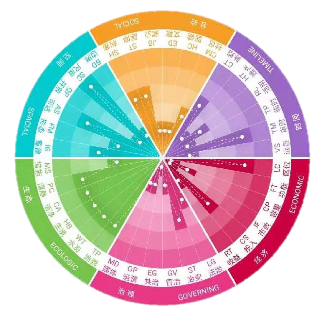
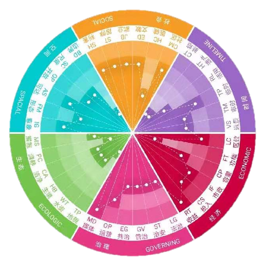
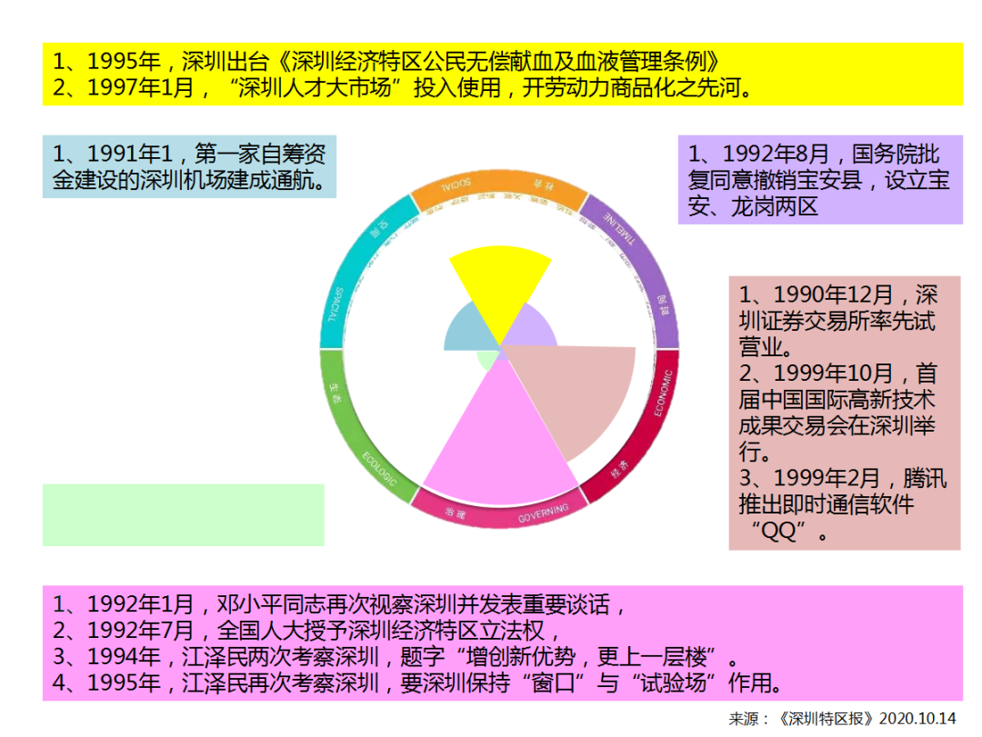
以可持续发展的三个关键方面(经济、生态和社会)为基础,我延伸了三条坐标轴(时间、空间和治理),建立了一套可以评价资源与规划建设影响的6维评估方法,每个维度都有6个子项评价因子。我将评估深圳每十年的变化,并重点讨论每十年的一个关键影响力量。我希望这套方法有助于更全面地看到城市是否均衡和健康发展。
Based on the three key aspects of sustainable development (Economical, Ecologic and Social ), I have extended 3 coordinate axes(Space, Time and Governing), established a set of 6-dimensional assessment that can evaluate the impact of resources and planning / construction. Each dimension has 6 factors. I’ll assess the changes in Shenzhen every ten years and focus on one of the key influences. I hope this method or framework will help to see more comprehensively whether the city is developing in a balanced and healthy manner.

六维评估
6 Dimensions Assessment
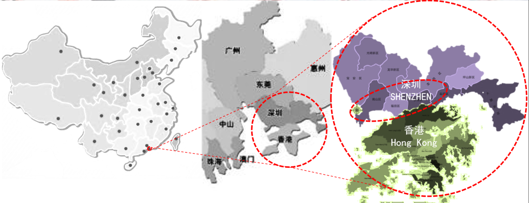
深圳1979-1990: 香港地缘的影响
Shenzhen 1979-1990: The Influence of Hong Kong
深圳第一个十年,我重点谈香港对深圳的地理影响。
In the first decade of Shenzhen, I will focus on the geographic influence of Hong Kong on Shenzhen.

1979
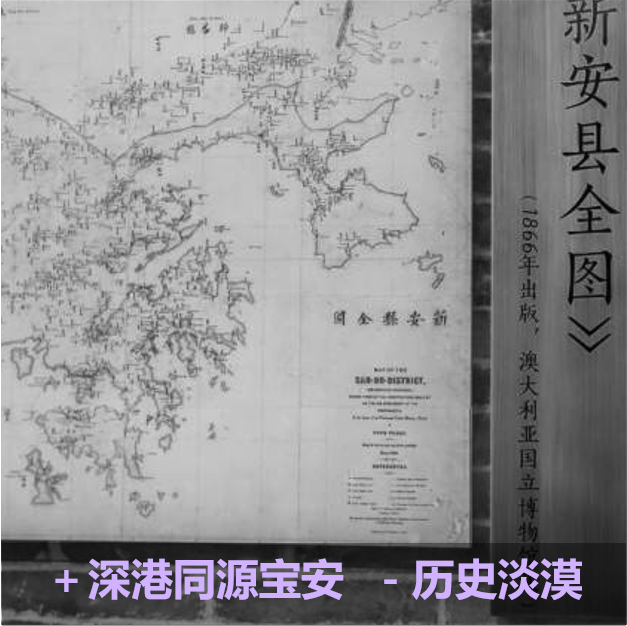

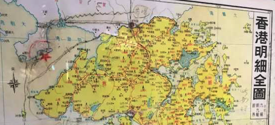
深圳关键资源1979:毗邻香港,同源宝安
在1979年(升级为城市和建立经济特区)之前的深圳,最重要的资源是毗邻香港同在珠江口的地理位置,有相同的历史与血缘联系。因为制度差别所产生的两地100倍的收入落差,导致了宝安和内地接近百万人次的大逃港。
Before 1979 (upgrading to a city and establishing a special economic zone), Shenzhen's most important resource was adjacent to Hong Kong's geographical location at Pearl River Estuary, with the same history and blood connections. The 100-fold income gap between the two places caused by the different systems led to the Great Escape to Hong Kong by nearly a million people from Baoan and the mainland.
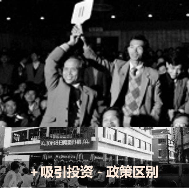
务实的邓小平不认同靠边防管控防止逃港的做法。他顺应潮流,解开束缚中国人的计划体制绳索,让四亿劳动力的部分,可以在深圳特区与全球化的资本率先相遇,高压30年的中国能量终于在358平方公里的边境地带释放出来,形成“井喷”奇观。
The pragmatic Deng Xiaoping did not agree the way rely on border control to prevent escape to Hong Kong. He followed the trend and untied the ropes of the planning system that bound the Chinese, so that the part of the 400 million labor force could be the first to meet global capital in the Shenzhen Special Economic Zone. The 30-year high-pressure Chinese energy was finally released in the 358 square kilometers border area. Formed a "blowout" spectacle.
从1979年到2004年,深圳外企的83%和外资的60%来自香港。
83% foreign enterprises and 60% foreign investment of Shenzhen since 1979 to 2004 are from Hong Kong.

1980年后香港有8万家工厂搬迁到深圳和内地
80,000 Hong Kong factories moved to Shenzhen and mainland since 1980
1987年中国土地有偿出让的第一槌在深圳敲响,这是学习香港土地批租制度的结果,也是中国城市土地财政的源头。
In 1987, the first hammer of the paid sale of land in China was struck in Shenzhen. This was the result of studying the land lease system in Hong Kong and the origin of China's urban land fiscal revenue.

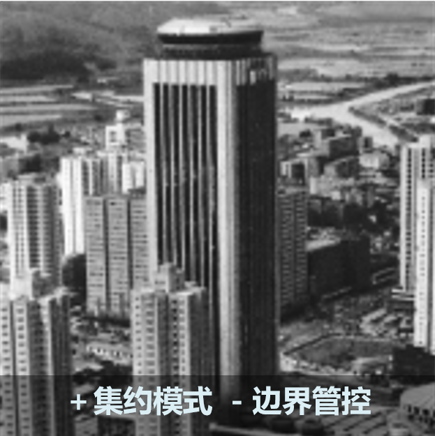
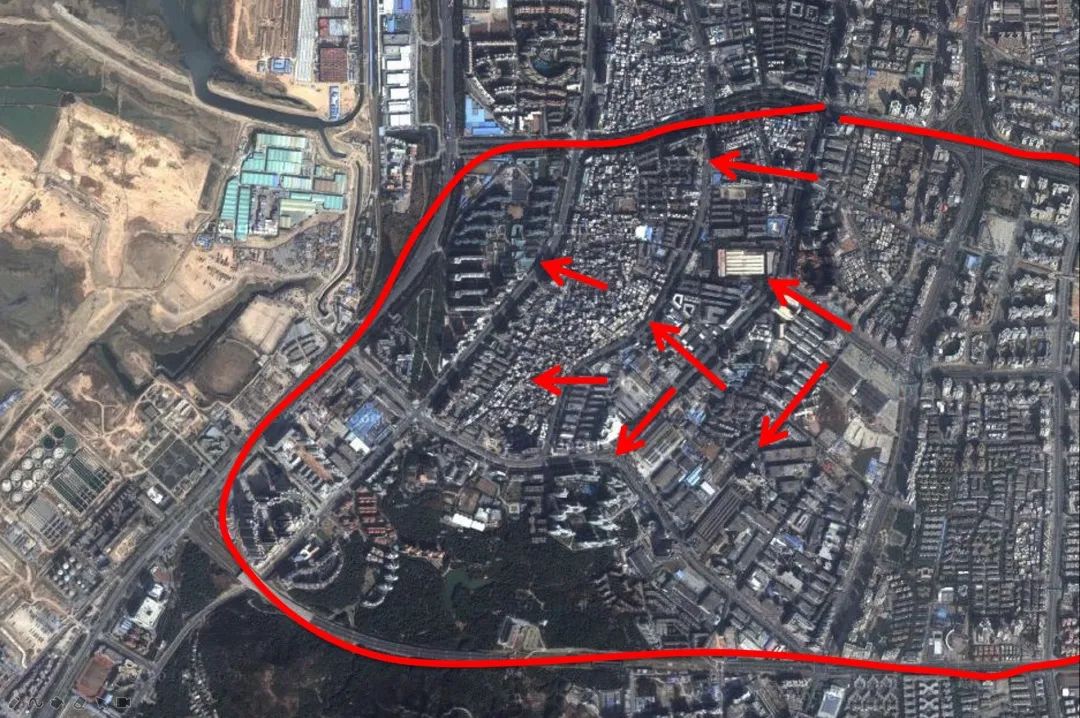
深圳城市规划体系及委员会制度也是从香港学习而来,从1999年起深圳法定图则就与内地规划体系不同,直到现在。早期罗湖的规划建设呈现非常紧凑的特征,显然受到香港高密度城市开发模式的影响。
Shenzhen’s urban planning system and committee system were also learned from Hong Kong. Since 1999, Shenzhen’s statutory plans have been different from the mainland’s planning system until now. The early planning and construction of Luohu presented a very compact feature, which was obviously affected by the development model of Hong Kong's high-density city.


受香港影响的罗湖高密度城市开发模式
High density development learn from Hong Kong
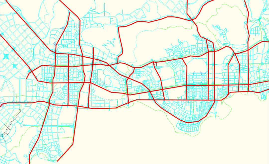
我要特别强调的是,纵观深圳40年形成的空间结构,深圳不同年代的开发热点(1980’s:蛇口/罗湖;1990’s:福田;2000‘s:龙华/后海;2010’s:光明/前海/沙井/坪山),实际上都受到不同年代深港交通走廊(1980’s:蛇口港/广九铁路;1990’s:广深高速/皇岗口岸;2000’s: 广深港高铁/西部通道/深圳湾口岸;2010’s:广深港高铁/沿江高速/高铁)的强烈引导,从而在深圳地理空间上留下非常底层的、结构性的、容易被忽略的香港影响,我称之为深圳的“香港导向开发”模式。
What I want to emphasize is that, looking at the spatial structure of Shenzhen over the past 40 years, Shenzhen’s development hotspots in different years (1980's: Shekou/Luohu; 1990's: Futian; 2000's: Longhua/Houhai; 2010's: Guangming/ Qianhai/ Shajing / Pingshan), are actually affected by the Shenzhen-Hong Kong transportation corridors in different eras (1980's: Shekou Port/Guangzhou-Kowloon Railway; 1990's: Guangzhou-Shenzhen Highway/Huanggang Port; 2000's: Guangzhou-Shenzhen-Hong Kong High Speed Rail/Western Corridor/Shenzhen Bay Port; 2010's: The Guangzhou-Shenzhen-Hong Kong High-speed Railway/Yanjiang Highway/High-speed Railway) has left a bottom-layer, structural, and easily overlooked Hong Kong influence on the geographical space of Shenzhen. I call it Shenzhen’s "Hong Kong-oriented development" model.
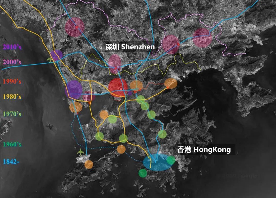
HKOD: 深圳空间结构受到的香港影响
HK Oriented Development: The Spatial Structure of Shenzhen Driven by HK
在深圳官方发布的四十周年大事记中,第一个十年有这些大事。用我建立的6维评估框架来衡量,生态维度是空白,空间、历史和社会维度是相对被忽略的。
In the 40th anniversary memorabilia officially released by Shenzhen, these major events occurred in the first ten years. Measured by my 6-dimensional assessment framework, the ecological dimension is blank, and the spatial, historical and social dimensions are relatively ignored.

深圳第一个十年,治理层面上,在邓小平改革路线下,袁庚在蛇口超出经济改革之外的治理试验是不能忘记的探索;“开山炮”、炸山填海的传奇叙述同时也隐含了环境破坏式开发观念和做法值得省思;以国贸大厦为标志,深圳追求着一种现代化城市空间意象;社会维度上,深圳所提供的打工机会让当时的国人体验到迁徙和就业的相对自由并爆发出无穷的创造力;经济开放带来着中国大陆的众多“第一个”体验;而在时间/历史性这个维度,梁湘市长任内建设的包括深圳大学在内的八大文教设施,是极具历史眼光和平衡发展远见的。这是我对深圳第一个十年的简要6维评估。
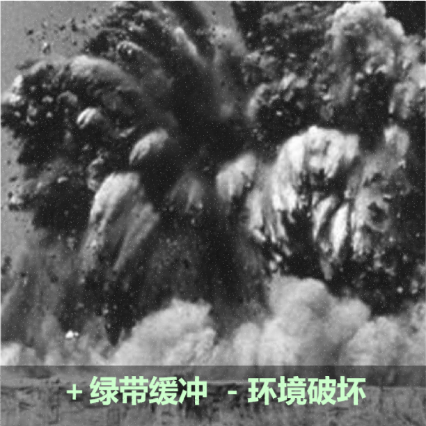
In the first decade of Shenzhen, innovation in Shekou were an exploration that must not be forgotten; the legendary narrative of blasting mountains and reclaiming the sea also implies the idea and model of environmentally destructive development; with the International Trade Building as the landmark, Shenzhen pursues a modern city space image; job opportunities allow the Chinese people at that time to and burst out infinite creativity; economic opening has brought many “firsts” experience in China; In the dimension of time/history, the eight cultural and educational facilities, including Shenzhen University, have a historical perspective and a vision of balanced development. This is my brief 6-dimensional assessment of Shenzhen for the first decade.
1979
1989

深圳巨变(1979-1989):香港影响
Shenzhen Boom(1980-1990): Learn From Hong Kong
深圳1990-2000: 划圈规划的影响
Shenzhen 1990-2000: The Influence of Circle-Drawing Plan
深圳第二个十年,我重点谈自上而下规划的影响。
In the second decade of Shenzhen, I will focus on the impact of top-down planning.
有一首深圳人创作和流行的歌颂改革开放的歌曲《春天的故事》,其中一句歌词“有一位老人在南海边上画了一个圈”,很形象表达了中国的画圈决策动作。画圈在中国既是一种官员参与决策的具体动作(在送审文件上画圈表示已阅和同意),也是一种规划分区方法。
There is a song "The Story of Spring", created and popular by Shenzhen residents to eulogize the reform and opening up. One of the lyrics is "An old man drew a circle on the South Sea", which vividly expresses China's decision-making actions in the circle. Circle drawing in China is not only a specific action of participating in decision-making by officers(drawing a circle on the submitted documents to indicate that they have been read or agreed), but also a method of zoning by urban planners.
“有一位老人在南海边上画了一个圈”?
“An old man drew a circle beside the South China Sea”?
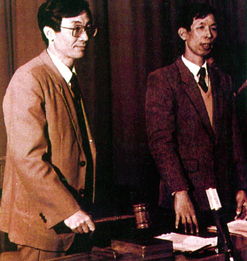
确实有一位国家副主席李先念先生,真的在袁庚请示兴办蛇口工业区的香港地图上画了圈。而袁庚以地图上这个小圈圈为依据,从蛇口农村集体那里获得了2平方公里的开发土地。
Indeed, there is Mr. Li Xiannian, Vice President of the State, who really drew circles on the map of Hong Kong where Yuan Geng applied for setting up the Shekou Industrial Zone. Based on this small circle on the map, Yuan Geng obtained 2 km2 land to develop from the Shekou Rural Collective.
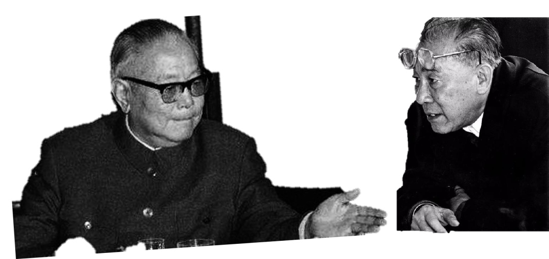
左:李先念 右:袁庚
Left: Li Xiannian, Right: Yuan Geng
1979年1月,另一位老人在香港地图边上画了一个圈:中国首个对外开放的工业区诞生了。
Another old man drew a circle at the side of a Hong Kong map in Jan.1979: This was the first industry park in Chian open to the world.
正是采用画圈的区划方法,早期深圳迅速将大片土地划拨给当时的大型国有企业,开发了蛇口(交通部香港招商局)、南油片区(南海石油公司)、华侨城(侨办华侨城公司)、天安车公庙(泰然+香港天安集团)、福田保税区(深圳国企)、华强北(各工业部企业)、白沙岭(深圳国企)、八卦岭(各深圳国企)…
In the early days, Shenzhen quickly allocated a large area of land to large state-owned enterprises through this circle-drawing zoning, and developed Shekou, South Sea Petroleum Area, Overseas Chinese Town, Chegongmiao, Futian Free Tax Zone, Huaqiangbei, Baishaling, Baguiling...

圈划飞地模式:国企成片区开发与城中村自发建设
Draw Circles as Enclave: The Mega-block development by SOEs (State Owned Enterprise) and informal urban villages by villagers
1986年的总体规划把这种画圈分区具体描述为带状组团式布局,组团之间留下的绿色缓冲带,为深圳奠定了避免城市蔓延、具有良好生态环境和弹性发展的总体布局和结构。这一由北京规划团队带来的绿带缓冲区理念和做法,可以追溯到50年代苏联帮助所做北京规划的楔形绿带(更早则来自19世纪霍华德田园城市设想、1938年英国《绿带法》、1944年大伦敦规划绿化圈、1947年丹麦哥本哈根手指状绿带)。
The 1986 master plan specifically described this circled zoning as a belt-cluster layout. The green buffer zone left between clusters defined the overall layout and structure for Shenzhen to avoid urban sprawl, have a good ecological environment and flexible development. This green belt buffer concept and practice brought by the Beijing planning team can be traced back to the wedge-shaped green belt that the Soviet Union helped to make Beijing planning in the 1950s (earlier from the 19th century Howard’s pastoral city design, 1938 British "Green Belt Act", Greater London Planning Green Circle in 1944, Copenhagen Finger Green Belt in Denmark in 1947).
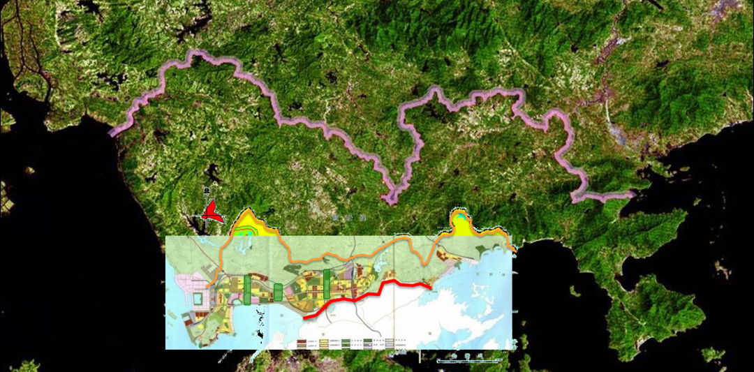
带状组图多中心:深圳第一次总体规划确定的布局
Belt/Groups/Multi-Centers : The Shenzhen Layout by First Master Urban Plan
当然深圳的爆发给城市规划带来的挑战是,每次的人口增长规模预测都被后来的发展大大超越,只有不确定性才是确定的。
Of course, the challenge brought by the outbreak of Shenzhen to urban planning is that every time the population growth forecast is greatly exceeded by subsequent developments, only uncertainty is certain.
自上而下等级分明(总体-分区-片区)的城市规划体系也难以适应深圳发展的高速度。就拿南山区的南油片区来说,2002年才有南山区总体规划,2008年才有法定图则,现实发展其实无法等待如此滞后规划的引领。而每个画圈分区独立规划和发展带来的问题是,每个分区的道路网络都是不一样的、甚至充满断头路。
The urban planning system with a clear hierarchy from top to bottom (overall-district-district) is also difficult to adapt to the high speed of Shenzhen's development. Take the Nanyou area in Nanshan District as an example. The Nanshan District master plan was only available in 2002, and the statutory plan was only available in 2008. Actual development cannot wait for such a lagging planning to lead. The problem with the independent planning and development of each circled zoning is that the road network of each district is different, even full of dead ends.
南油新区街道网
Street Network of the Super Block of Nanyou Area
华侨城这个圈团就是按大型居住区和主题旅游区来规划路网,特意采用的三岔路,目的是不欢迎无关车辆进入,后果是这个地区特别缺乏相互联通的道路网络。
The OCT circle-zone is to plan the road network according to the large-scale residential and theme park area. The three-way road is deliberately used to prevent irrelevant vehicles from entering. The consequence is that this area is particularly lacking in interconnected road networks.

华侨城超级街区街道网
Street Network of the Super Block of OCT
我忍不住拿深圳的组团城市路网来跟曼哈顿做比较…如果在画圈分区之前,先在能用于开发的土地上画满格子,是不是从规划的图面工作上、以及城市交通及土地利用上都会更有效率呢?
I can’t help but compare Shenzhen’s cluster-city road network with Manhattan...If you draw a grid on the land that can be used for development before circle-zoning, will it be more efficient in terms of planning graphics, urban transportation and land use?

深圳可以更简便地用一个整体的网格来规划吗?
Could Shenzhen be planed more simple with a whole grid?

深圳城市规划存在哪些问题?
What are the problems in Shenzhen's urban planning?
问题1
一是自上而下、等级繁多的系统与现实需求及实践存在着结构性矛盾。
One is that there are structural contradictions between the top-down, multi-level system and actual needs and practices.

自上而下 VS.自下而上:中国城市规划结构性矛盾
Top-Down Vs. Bottom Up: The Contraction of Chinese Urban Planning System
问题2
问题二是城市规划居住用地分类以及开发模式上,与数量庞大的外来人口对可承担住宅、保障房、公租廉租房用地的巨大需求之间,存在巨大的结构性错位。
The second problem is that there is a huge structural dislocation between the planning-classification of residential land and its development model, and the huge demand for affordable housing and low-rent public rental housing by a large number of migrants.


人口结构比例
Population structure ratio
“城中村犹如城市不可缺少的下半身…上下半身之间的要素可以流动转化,但其上下半身的相互依存和机能分工却是永恒存在的。换句话说,如果要把大部分城中村推倒重建成高档楼盘,不管城市乐意与否,那些原城中村的租户会转移到新的区域新的犄角旮旯中,塑造新的下半身形态和机能,因为他们和城市相互需要”。
——2006年城道博客文章《城市的下半身》
问题3
问题三是城市规划对一定期限的终极和固定的想象,与中国地方领导经常变化的任期之间,难以匹配。
The third problem is that the ultimate and fixed imagination of urban planning for a certain period of time is difficult to match with the frequently changing tenure of local leaders in China.
用六维框架观察到的深圳第二个十年的官方大事叙述是这样的。
The official narrative of Shenzhen's second decade of events observed in a six-dimensional framework is like this.
在深圳的第二个十年,改革开放的新动力仍然来自邓小平对深圳的第二次巡视,尽管1992年深圳特区同时获得立法权,之后也建立了法定规划体系;随着开发地区及高层建筑日益增多,城市设计的需求随之产生并在规划部门设置了中国首个城市设计管理处室;经济上深圳开始转型金融、高科技产业;延揽人才和清理人口同时存在;千年养蚝环境不再,代表农业的荔枝节也让位给高交会。
In the second decade of Shenzhen, the new impetus for reform and opening up still came from Deng Xiaoping’s second inspection of Shenzhen. Although the Shenzhen Special Economic Zone obtained legislative power in 1992, a statutory planning system was also established afterwards; with the increasing number of under development areas and high-rise buildings, The demand for urban design has arisen and China’s first urban design management office has been set up in planning bureau; economically, Shenzhen has begun to transform into financial and high-tech industries; recruiting talents and cleaning up the population exist at the same time; the millennium oyster farming environment is no longer,the Litchi Festival which represents agriculture also give way to the High-Tech Fair.
1990
1999


深圳巨变(1990-1999):开始产业升级转型
Shenzhen Boom(1980-1990): From World Factory To Hi-Tec/Financial
到了深圳的近二十年,城中村迅速扩张,深圳开始引进基于形式和公共空间的街区城市设计方法,商业房地产高速发展,房价也飞涨…随着深圳取得的成就越来越大,我们又能从中获得什么启示?
敬请读者期待《深圳巨变六维评估》下篇。
-To be Continued-
编辑:钱梓涵


未来 + 学院 是一所面向中国城乡问题,融研究、教学与实践于一体的非正规学院。学院应用批判思维、设计思维和系统思维,探索村城营造——一种适用乡村与城市的规划建设方法,系统提升城乡品质。未来+在创新教育同时,还以“空间智库”方式介入实践,以“栖居实验室”负责研发。目前研发产品和工具包括六维资源/影响评估、六维城市互动智能模型、六维村城营造课程。未来 + 学院学员对象主要为愿意摆脱惯性思维和路径依赖、致力于提升栖居品质的人,包括学生、专业者、管理者和爱好者。
未经允许不得转载:FuturePlus » 深圳补惑(1)| 如何看深圳巨变(上)
 进阶城市设计:诗意栖居营造法式(上)
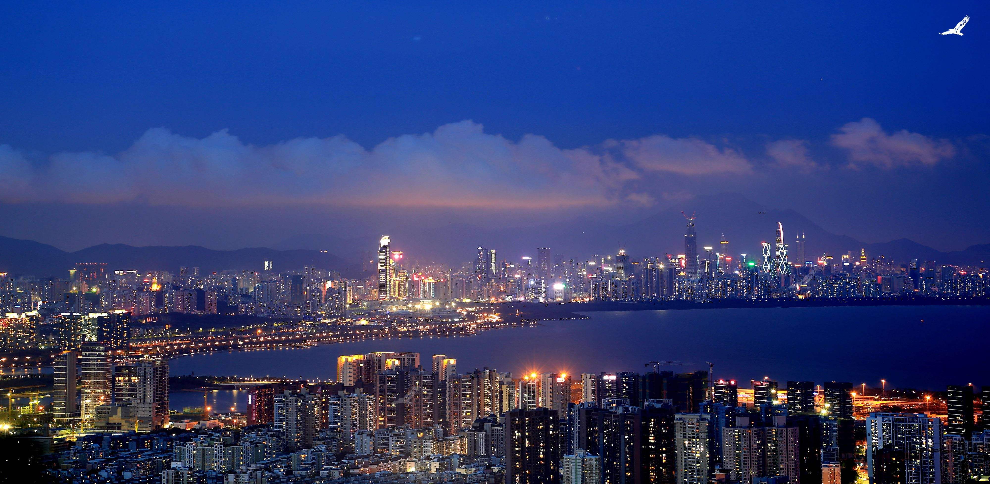 深圳补惑(1)| 如何看深圳巨变(上)
 人工智能聊城市 |北京重庆竟遭 AI 点
 总师课题 | 大鹏半岛住宅城市设计指引研
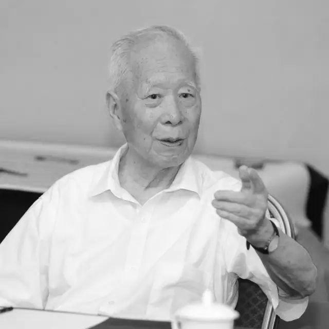 追忆 | 历史保护型城市设计的开拓者走了